
NSTC-Funded Research Project
GIS Analysis of Qing Maps of the Western Regions and the Visualization of Historical Transport Routes
Mapping and Transmission of Geographical Knowledge between the Qing Western Territories and Eurasia
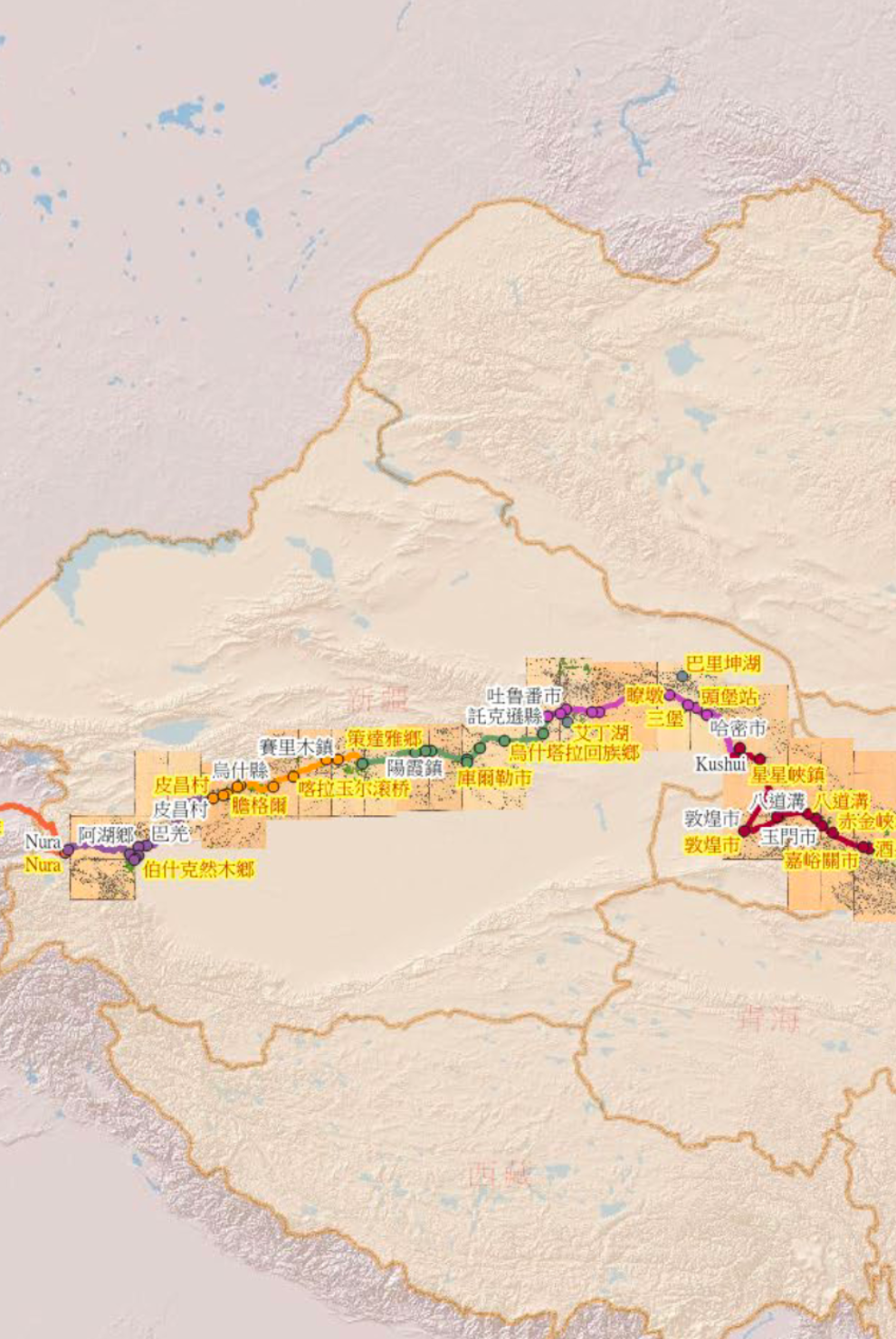
This project expands the primary-source base for the study of Qing maps of the Western Regions, focusing on rare manuscript maps that have not yet received sufficient scholarly attention, and combines sources in Chinese, Manchu, Mongolian, Tibetan, and Turkic languages in an integrated study that gives equal weight to textual and visual materials. From the perspective of world history, it re-examines the multicultural background of Qing cartography and geographical knowledge—especially the influence of diverse Eurasian knowledge traditions, including Manchu, Mongolian, Tibetan, Turkic, Russian, and Islamic ones—in order to bridge the research paradigms of Chinese, Inner Asian, and Eurasian history. Combining qualitative and quantitative methods from comparative philology and the digital humanities, the project builds on close study of the maps and their multilingual contexts to identify historical place names and transport routes, and uses digital technologies such as Geographic Information Systems (GIS) to produce multi-layered overlay maps that trace changes in historical geography, achieving genuine interdisciplinary integration.
- Institute of History and Philology, Academia Sinica
- March 1, 2022 – July 31, 2025
NSTC-Funded Research Project
GIS Analysis of Qing Maps of the Western Regions and the Visualization of Historical Transport Routes
Mapping and Transmission of Geographical Knowledge between the Qing Western Territories and Eurasia
This project expands the primary-source base for the study of Qing maps of the Western Regions, focusing on rare manuscript maps that have not yet received sufficient scholarly attention, and combines sources in Chinese, Manchu, Mongolian, Tibetan, and Turkic languages in an integrated study that gives equal weight to textual and visual materials. From the perspective of world history, it re-examines the multicultural background of Qing cartography and geographical knowledge—especially the influence of diverse Eurasian knowledge traditions, including Manchu, Mongolian, Tibetan, Turkic, Russian, and Islamic ones—in order to bridge the research paradigms of Chinese, Inner Asian, and Eurasian history. Combining qualitative and quantitative methods from comparative philology and the digital humanities, the project builds on close study of the maps and their multilingual contexts to identify historical place names and transport routes, and uses digital technologies such as Geographic Information Systems (GIS) to produce multi-layered overlay maps that trace changes in historical geography, achieving genuine interdisciplinary integration.
- Institute of History and Philology, Academia Sinica
- March 1, 2022 – July 31, 2025
Principal
Investigator

Ling-Wei Kung
Assistant Research Fellow, Institute of History and Philology, Academia Sinica
Research fields: Yuan, Ming, and Qing China and Eurasian exchange; history of science and technology; global history; Inner Asian philology
Co-Principal
Investigator

Richard Tzong-Han Tsai
Research Fellow, Research Center for Humanities and Social Sciences, Academia Sinica
Research fields: natural language processing, dialogue systems, deep learning, biomedical text mining, sentiment analysis, cross-lingual processing, digital humanities
Principal
Investigator
Ling-Wei Kung
Assistant Research Fellow, Institute of History and Philology, Academia Sinica
Research fields: Yuan, Ming, and Qing China and Eurasian exchange; history of science and technology; global history; Inner Asian philology
Co-Principal
Investigator

Richard Tzong-Han Tsai
Research Fellow, Research Center for Humanities and Social Sciences, Academia Sinica
Research fields: natural language processing, dialogue systems, deep learning, biomedical text mining, sentiment analysis, cross-lingual processing, digital humanities